
a short history of hungerton & wyville

the prehistoric period
The land here has been inhabited for thousands of years, firstly by a succession of prehistoric peoples whose contribution is extremely difficult to assess. However, as one of the upland areas of Lincolnshire, the landscape was almost certainly ‘tamed’ from an early period, and signs of this can best be seen with aerial photography.
To the west of Hungerton are ‘King Lud’s Entrenchments’, a length of prehistoric banks and ditches which form part of an extensive boundary system stretching from Northamptonshire to the Humber (the ‘Jurassic Spine’). Forming the western border of the farm is ‘The Viking Way‘, part of an ancient highway that is now a Site of Special Scientific Interest. Running along the north boundary of the farm is ‘The Salters Way’, a road in use since Roman times, and possibly before, that ran from the fens near The Wash to the Midlands. ‘Three Queens’ contains the remains of at least one tribal queen, excavated during the 1970s and subsequently returned to the ground. The excavation also provided evidence of both Mesolithic and Neolithic occupation.
The many Bronze age barrows and the other finds here confirm that Hungerton and Wyville was a place that was favoured by these early peoples.

the Roman landscape
Although there are several indications of Romano-British occupation (pottery, quern stones and coins) both over the farm and beyond, there is no direct evidence of a settlement within the boundary. One of the many springs here has a retaining wall that appears to have been built using Roman stone, although there is no certainty that this was in-situ during Roman times (most likely the stone was repurposed later).
There was a significant find in the early 18th Century of a Roman tessellated pavement and, subsequently, of the ruins of a Roman Villa half a mile north of us. A page written about The Estate back in 1801 (from which the main image here is taken), says:
From this pavement to the spring… a causeway has been traced beneath the surface of the earth, which probably was made for a communication between the Roman station and the village, and for the purpose of bringing water to the former.
Unfortunately the Villa and the causeway were demolished by quarrying for ironstone on the neighbouring estate in the 1950s and 60s.

domesday
Although there is no clear evidence of a settlement in the Roman period, or indeed for some centuries after, by the time we arrive at Domesday (1086) there are two hamlets – Wyville and Hungerton – both of which are located in the valley which forms the link between them. An important factor in their location was no doubt the readily available supply of water in this upland area (over 122m – 400 ft – above sea level).
The Domesday entries read:
In Wyville, Eddiva had six carucates of land rateable to gelt: the land is as many carucates. Robert de Todeni has there three carucates in demense, and thirteen villeins with four carucates. The annual value in King Edward’s time was 4l 5s 4d (four pounds, five shillings and four pence); it is now 100s, and is tallaged at 20s.
In Hungerton, there are six carucates of land rateable to gelt: the land is carucates. Thirteen villeins have there six carucates, and fifty acres of meadow, and eighty-seven acres of underwood. The wood is in the Soke of Grantham.
Whilst care is needed in the interpretation of the Domesday Book, the thirteen villeins in each settlement may represent the heads of households. A carucate is “the medieval unit of land area approximating the land a plough team of eight oxen could till in a single annual season” and each settlement is said to have 6 carucates (which in Lincolnshire is roughly 120 acres). Normally there are 12 carucates in a parish, which is more or less the area of the present farm.
There was a church at Wyville, dedicated to St Catherine, although it was not on the site of the current St Catherine’s - it was likely situated near what is now Sycamore Farm, where stone coffins were discovered in 1842. Hungerton Hall also used to have a chapel situated in the woodland behind the house, although this is now long gone.
Between the Hungerton and Wyville open fields lies the large open and unreclaimed area of Wyville Heath, part of which looks to have been more actively managed in the Bronze Age.
Other than the woodland mentioned in the Domesday entry, the parish would have been largely bereft of trees, other than some scrub and stunted trees randomly scattered over the heath which would have been used for common grazing.

medieval settlements and landscape
Both Hungerton and Wyville increased in size after the Conquest, with arial photographs taken back in 1947 indicating that in the early medieval period virtually the whole of the area of ‘old’ enclosure at Wyville was being used for arable farming. Close to the settlement lay areas of hillside grazing, a remnant of which still exists today. Too steep to cultivate, the hillside would have provided valuable sheltered and accessible pasture. These days those same uncultivated pastures, with the same undisturbed soil, are maintained as wildflower meadows and hold an exceptional quality and variety of flora.
The Black Death appears to have seriously affected the two settlements. The initial outbreak was in 1348, but there were several recurrences in the third quarter of the 14th Century. The plague marked the end of what prosperity there was in the two villages, not with total depopulation but a significant shrinking of the settlements. “Land remained uncultivated or lost value through lack of tenants at… Wyville and Hungerton in 1362” -Platts. Platts asserts that sometimes “it was the hamlets whose name testifies to the poor, stony quality of the surrounding land… as at Hungerton” which suffered the economic consequences.
The fall in population also had an effect on the farming system, with many farming landlords finding it difficult to find tenants. In most parishes the area used for arable cultivation fell markedly and many outlying areas were put down to pasture – Wyville and Hungerton being no exception.

The Tudor and Stewart Periods (1480-1700)
There are a few archived documents that give us an understanding of how the land was used, but it isn’t until the end of this period that we finally get a good idea about the state of the settlement. In 1702 a contract was written giving ownership to George de Ligne Gregory,
moiety (half) of the manor of Wyville and Hungerton, and 15 messuages (houses with outbuildings and land), 13 cottages, 4 windmills, 10 gardens, 10 orchards, 1200 acres of land, 200 acres meadow, 711 acres pasture, 150 acres wood, 800 acres gorse and heath, and 13s 4d rent.
It isn’t surprising that the acreage doesn’t add up to what we’d consider the correct number for The Estate, as the use of rounded figures was little more than a conveyancing convention during this period, therefore the numbers shouldn’t be relied upon.
By the end of 1700, map evidence suggests that Hungerton had become almost entirely depopulated and the buildings of the village lost. By contrast, at Wyville some cottages and a few farmsteads remained. Beyond the two settlements the land was largely no longer in arable cultivation.
1700-1770 and the Enclosures
The great majority of the parish, being in the ownership of the Gregory family, changed only slightly over the next 70 years. The two main alterations were the addition of a new farmstead out by Three Queens (which was eventually demolished in the third quarter of the 1900s) and, eventually, an enclosure award for Wyville Heath.
To appreciate the desire to enclose the heath we need to understand contemporary agricultural thinking. Innovations in agricultural practice finally made it possible to cultivate all but the poorest soils by crop rotation. Multiple land uses were ‘despised’, bracken and ling were no longer regarded as crops and rabbits had begun to be disapproved of (rather than seen as a valuable food source). The enclosure of land also conferred on owners absolute rights over their properties (moving away from common grazing land), and contemporary writers were extolling the virtues of ‘reclamation’ and drawing attention to the significant rent increases that could be obtained.
Therefore the enclosure of Wyville Heath would have been seen by the Gregory’s as an excellent way of increasing the productivity of The Estate, and they paid £800 for the privilege. For comparison, the average worker in 1770 was earning seven shillings a week, there are 20 shillings in a pound, so £800 is the equivalent of 44 years income.
The addition of so much newly reclaimed and enclosed land meant that new buildings also had to be built to serve it. Not only was this an agricultural necessity but a financial one too, as the existing farms wouldn’t produce an increase in rent without the infrastructure to support their newly allotted land. This included improving and extending Hungerton Farm (now Field House), and both Beech and Sycamore Farms at Wyville, as well as creating a new outlying set of buildings and a yard at Wyville Lodge.

the building of hungerton hall
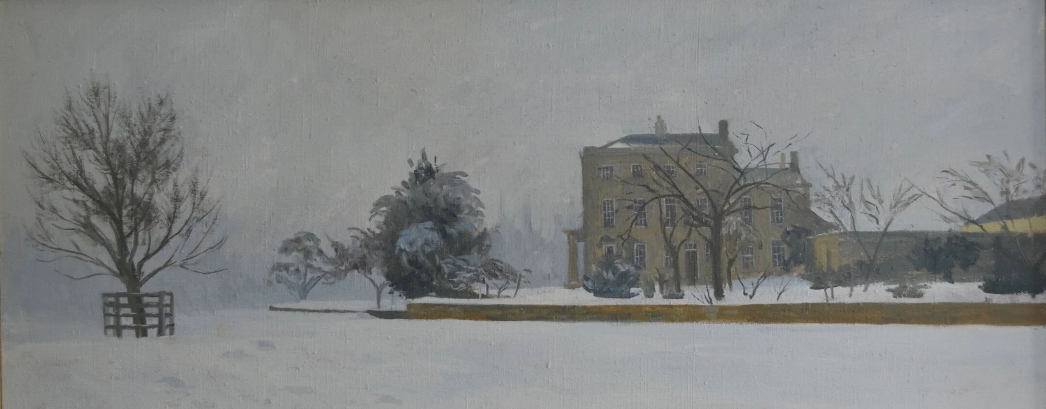
By the latter half of the 18th Century George de Ligne Gregory’s wealth included considerable property in Nottingham, Lenton, and Radford, and holdings in various canal and railway companies, along with a smaller estate at Hungerton and Denton. About 12 years after the enclosure of the heath, he decided to live at Hungerton, and work started on the Hall and stables in 1782. The building was finished three years later, in 1785, and was constructed of squared limestone rubble (at one stage stuccoed) with a slate roof.


The site selected for the Hall, “seated on an eminence“, at one of the highest points in Lincolnshire (137m above sea level), commanded fine views over much of the parish. What Gregory appears to have underestimated, however, was the downside of the position he’d chosen – exposure to the elements. The only shelter from the winds were a few thin trees to the north west and, considering the prevailing winds come from the south, the new building was very exposed.
At the end of his first winter there, Gregory wrote to Sir Thomas Hartnell, explaining the fact that the loss of his mother had frustrated his plan of happiness and that he found the location of the Hall “particularly inconvenient on many accounts“. Apart from it being “out of the line of communication with the neighbourhood” it was “also very naked and bleak that it will by no means do for a winter residence“.
There is little doubt that Gregory’s comments were heartfelt. Not only was the Hall very exposed, but several of the 1780s winters were exceptionally lengthy and cold – some so bitter that the Thames froze over. [Thankfully freezing winters at Hungerton Hall are now a thing of the past since the recent addition of a 250kW biomass boiler, that takes up the size of a small house, and provides an endless supply of hot water and heating to the Hall and surrounding cottages]
As a side note, Gregory de Ligne Gregory, the nephew of George (who inherited from his uncle in 1822), lived at Hungerton whilst he built another notable property, Harlaxton Manor, which was completed in 1845, and situated two and a half miles from Hungerton. Its construction combines elements of Jacobean and Elizabethan styles with symmetrical Baroque structures, making it unique among surviving Jacobethan manors. Harlaxton Manor is now the British campus for the University of Evansville.

the twentieth century
With The Estate still in the ownership of the descendants of the Gregory’s, who resided at Harlaxton, Hungerton Hall was let to a succession of tenants, including the (not very good) cricketer and Member of Parliament for Grantham, Arthur Priestly. In 1937 Mr Pearson Gregory (who was then in his nineties) died and the Harlaxton Estate – of which Wyville cum Hungerton was a part – was split up. The property was eventually bought by the Le Marchant family in 1939.
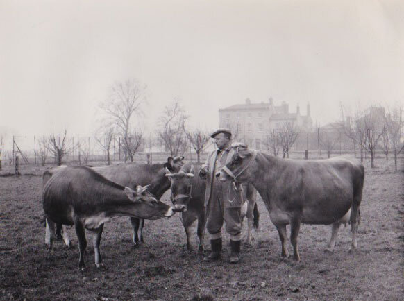
Having carried out a few alterations to the Hall prior to moving in in July 1939, Sir Denis Le Marchant (first row, second from the right) was called up at the outbreak of WWII and the Hall was requisitioned by the army in December. It became the HQ for various regiments, including the South Staffordshire, and the last who left for Arnhem. When the Hall was finally returned after the war, parts of the premises were under water from a leaking main, there was no light or heat, and the doors had been burned as firewood. Outside there were Nissen huts on concrete foundations and the stables had been used by the army as a prison. Wyville Lodge (the current shooting school) had also been requisitioned, and many military buildings were added along The Drift, with their foundations still visible today.
As part of the Government’s Shadow Factory Plan, BMARC (The British Manufacture and Research Company) was founded in Grantham, building aircraft and naval anti-aircraft cannons. Alongside the main factory in Grantham, a number of satellite munitions factories (we believe eight in total) were constructed in a wide circle around the town, solely producing 20mm calibre projectiles for the Hispano-Suiza HS.404 auto-cannon that were being manufactured in Grantham. One of these munitions factories was situated at Hungerton and is still in use today, primarily as storage.
Once the war was over, Sir Denis and Lady Elizabeth Le Marchant decided to repair and return to the Hall – the state that the army had relinquished it in was so poor that serious consideration was given as to whether to pull the entire structure down.
Other significant changes included the demolition of the Homestead farm at Three Queens, most of the old farm buildings at Hungerton Farm, some at Beech Farm and the derelict (by the early fifties) limestone cottages at The City. The Methodist Chapel and Burton’s Farmhouse at Wyville were also demolished, as well as most of the outlying buildings at Wyville Lodge (including all of the WWII buildings). In their place Hungerton Farm acquired a modern farmstead, the stone cottages in Hungerton Dip were extended, the White Cottages (next to St Catherine’s Church) were built and the cottages behind the Hall extended.
It is said that prior to their sale of The Estate, the Pearson Gregory’s felled all the valuable timber at Hungerton and Wyville to pay death duties. Much of the remaining woodland was lost in a severe gale at the end of the war. Other serious losses, particularly from the hedgerows, were caused by a storm in January 1976, and Dutch Elm Disease, which arrived on The Estate in the late 1970s. In response to these losses, starting in 1947, replanting the woodland became a priority, with the total land now given to woodland extending to some 35 hectares.
Sir Denis died in 1987, and Lady LeMarchant took on the mantle of running the estate for the next thirty years – although in all fairness she was very active here whilst Sir Denis was alive. She did pass some of the ownership of The Estate to her son, Sir Francis Le Marchant, a respected painter, who died in January, 2016. Lady LeMarchant died a few months later, aged 103, still overseeing the day-to-day operation of the estate until a couple of months before her death. The Hall is now occupied by her granddaughter, Isabel, and her family.

Sir Dennis, Lady LeMarchant, and a young Sir Denis LeMarchant
A Note of Thanks:
This history wouldn’t have been possible without the work of John Popham, planning and environmental consultant, who produced a history of Hungerton and Wyville for the Heritage Landscape Management Plan in June, 1999. Any errors or omissions are purely the fault of the author.